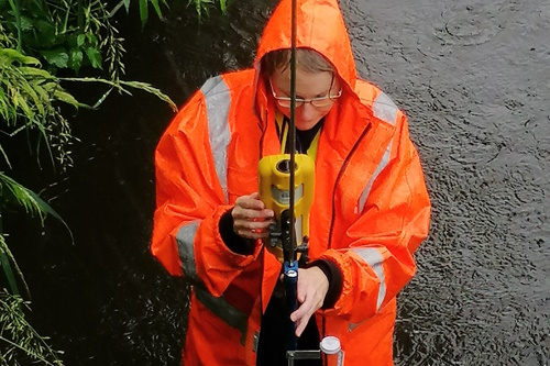
Dr Juliet Clague taking measurements in the Wharepapa Stream, a tributary of the Waitapu Stream
By Michelle Phillips and Juliet Clague
The health of our water is a major concern for many New Zealanders. But how can we identify which rivers and streams are healthy and which are not? Are complex scientific analyses the only tool we have?
The results of work we have done suggest the answer lies in western science and mātauranga Māori working together to identify waterway health.
Ngāti Tahu-Ngāti Whaoa is a Waikato River iwi with continuous occupation of their lands for over 800 years. The iwi takes a holistic view of river health and has always had a diet containing mahinga kai (wild foods).
In recent years, kaumatua had expressed concern about the state of the river and its tributaries. They noticed that the health and availability of tuna (eels) and koura (freshwater crayfish) had changed dramatically during their lifetime, for the worse.
This led the iwi to develop, in association with Manaaki Whenua Landcare Research, the Wai Ora Māori Assessment Tool (WOMAT) app, which uses an observer’s sensory observations to assess whether kai gathered from a particular waterway is safe to eat.
The app scores three categories:
- Mauri Ora – vitality – exploring the observer’s connection to the site and whether there is suitable habitat
- Whanau Ora – thriving families – whether whanau can share knowledge through gathering kai together
- Taiao Ora – flourishing nature – whether the kai is safe to eat, safe to access, and whether cultural practices can be undertaken.
At the same time Lincoln Agritech was leading the “Critical Pathways” programme to understand how water and nutrients move through different catchments. As part of this programme, scientists measured nitrate, ammonium, dissolved phosphorous, dissolved oxygen and mean residence time (the average age of water) in different water bodies.
Both activities were taking place in the Waiotapu Stream catchment – an area that is geothermally active and has a mixture of farming and forestry. We decided to compare our results – did mātauranga Māori and western science provide different paths to the same destination, or did they give very different results?
We found the two approaches largely agreed where streams are in poor health. High nitrate and phosphorous levels, as well as cloudy, muddy water result in poor habitat for kai species. They also often correspond with no shade, overgrowth of invasive weeds, rubbish from roadside littering, and tikanga no longer being practised because of concerns about water quality.
But there was not complete agreement – catchment land use and water age strongly affected the western science results, but not always the cultural assessments. The location with the most favourable Wai Ora assessment score had a strong historical and spiritual connection because it was close to a marae but had a relatively poor science score.
Conversely, the location with the best science score did not hold a special connection with the iwi, having been under crown or private ownership for generations. Also, there was no evidence of watercress growth and the proximity to the road made access potentially unsafe.
Overall, whether judged by the mātauranga Māori app or the western science measurements, stream health is poor throughout the catchment, and probably declining. This aligns with kaumatua stories of the declining state of mahinga kai areas in the rohe, compared with when they were younger.
This shows one example of western science and mātauranga Māori taking different paths to reach similar, if not precisely the same, destinations. By using both together, we can reveal a detailed, nuanced, and holistic picture of the health of our waterways.
Michelle Phillips is Environment Manager at Ngati Tahu-Ngati Whaoa Runanga Trust.
This article first appeared in the Waikato Times
See also


